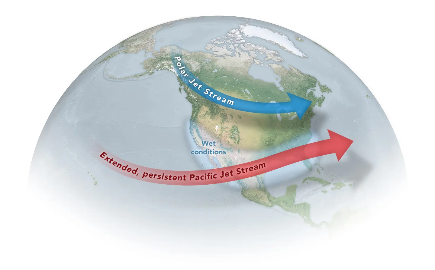
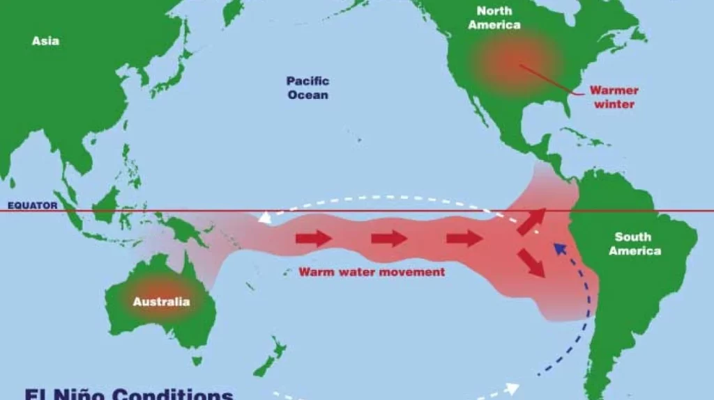
A potentially historic El Niño is developing in the Pacific. For Southern California’s wildfire communities, the consequences may be more complicated than simply expecting a wet winter.
For people who live with wildfire risk in Riverside County, the prospect of an exceptionally strong El Niño may sound like good news.
Rain is good for vegetation. Rain raises fuel moisture. Rain can interrupt the long periods of dry weather that contribute to wildfire conditions.
So, does a powerful El Niño mean Southern California can worry less about wildfire?
Not exactly.
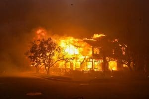
The relationship between El Niño and wildfire is considerably more complicated. A wet winter can temporarily reduce some aspects of wildfire risk while simultaneously setting the stage for substantial vegetation growth. That vegetation can eventually dry and become fuel. Meanwhile, Santa Ana winds don’t disappear because El Niño is present, homes remain vulnerable to embers, and Southern California’s most fire-prone communities remain exposed to wildfire whenever fuels, weather and an ignition align.
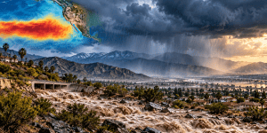
There is another issue as well. In communities that have already burned, heavy rain can transform the wildfire landscape into a flood, erosion and debris-flow hazard.
For Southern Californians living in and around the Very High Fire Hazard Severity Zone, the developing 2026–27 El Niño should therefore be viewed not as the end of wildfire season, but as another part of a continuously changing wildfire environment.
First, We Still Have to Get Through 2026
It is July.
Before thinking about what a wet winter could mean for next year’s vegetation, Southern Californians need to remember where we are today.
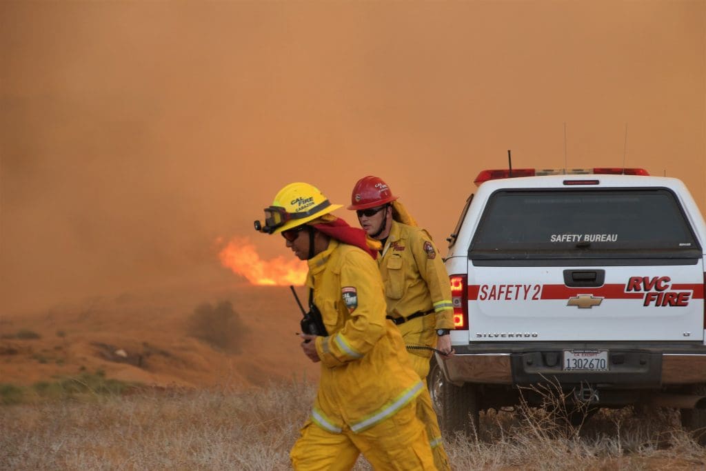
Vegetation across much of the region has been drying through summer, and the traditional period for significant offshore wind events still lies ahead.
CAL FIRE’s current seasonal outlook calls for above-normal temperatures in Southern California through September, which is expected to support continued drying of fuels. The agency says cool-season precipitation is expected to arrive before the onset of significant offshore wind events, although the timing of that transition remains uncertain.
In other words, El Niño may be developing thousands of miles away, but it hasn’t provided Southern California with a wildfire exemption.
A hot, dry and windy day remains a hot, dry and windy day.
And an ignition occurring under critical fire-weather conditions can still become a dangerous wildfire.
This El Niño Is Different Enough to Pay Attention
NOAA’s Climate Prediction Center reported that El Niño is strengthening.
The agency now places the probability of a very strong El Niño during fall and winter 2026–27 at greater than 90 percent.
Even more unusual, NOAA currently calculates a 69 percent probability that the event will reach a level during October through December exceeding previous El Niño events in the modern record dating to 1950.
Those numbers are extraordinary.
But they require an equally important qualification.
NOAA explicitly cautions that even an El Niño of exceptional strength doesn’t guarantee that the typical El Niño impacts will occur everywhere.
That matters enormously in Southern California generally and Riverside County specifically.
A powerful El Niño is a climate condition—not a forecast for a particular rainstorm, neighborhood or fire season.
We don’t yet know how much rain Riverside will receive, where it will fall, how frequently storms will arrive or what conditions will follow next spring and summer.
What we can do is understand the possible wildfire consequences and prepare accordingly.
Rain Changes Wildfire Risk. It Doesn’t Eliminate It.
If Southern California receives substantial winter precipitation, one immediate effect should be fairly intuitive.
Wet vegetation generally doesn’t burn like dry vegetation.
Cooler conditions, higher fuel moisture and repeated precipitation can suppress fire potential. Significant rain can effectively bring portions of the traditional wildfire season to an end.
But Southern California and Riverside County wildfire risk has never followed a simple calendar.
Periods of dry weather can occur within otherwise wet winters. Offshore winds can still develop. Vegetation can dry more quickly than people expect.
Most importantly, fire behavior depends upon multiple variables occurring together.
Fuel is one.
Weather is another.
Topography matters.
And there must be an ignition.
El Niño changes some of those variables. It doesn’t remove them.
Then Comes the Green
If Southern California experiences abundant rain, the visible transformation can be remarkable.
Hillsides turn green. Grasses emerge. Annual vegetation expands. Plants that struggled through dry conditions can grow vigorously.
To residents accustomed to seeing brown hillsides, that can look like a dramatically safer wildfire landscape.
For a while, it may be.
But green vegetation is still vegetation.
Eventually, much of that seasonal growth cures.
Green becomes yellow.
Yellow becomes brown.
And some of what grew because of abundant rainfall becomes fine, dry fuel.
Fine fuels such as grasses can ignite easily and allow fire to move rapidly across a landscape. They can also carry flames toward heavier vegetation and structures.
California has seen this pattern before. CAL FIRE’s review of the 2024 fire season specifically notes that unusually wet winter and spring conditions produced abundant fine fuels. When hotter conditions followed, those fuels became increasingly receptive to ignition and rapid fire spread. (CAL FIRE)
That doesn’t mean a wet 2026–27 winter will cause a severe 2027 wildfire season.
It means the vegetation produced by a wet winter becomes one of the variables we need to watch as conditions subsequently dry.
The Timing Matters
This is where homeowners and communities can make a difference.
If abundant precipitation produces substantial vegetation growth, waiting until that vegetation is completely dry before thinking about wildfire may be waiting too long.
Spring could become an important period for assessing what grew during winter and determining what needs to be maintained, thinned, removed or separated before summer and fall conditions return.
That doesn’t mean stripping hillsides bare.
It doesn’t mean eliminating every plant.
And it doesn’t mean treating all vegetation as dangerous.
Effective vegetation management is about reducing the ability of fire to move continuously through fuels while maintaining appropriate landscaping, slope stability and environmental values.
Southern California communities should therefore think about the wildfire year as a cycle:
Rain. Growth. Maintenance. Drying. Fire weather. Rain again.
El Niño may amplify portions of that cycle.
The Five Feet Around Your Home Still Matter
There is another reason residents shouldn’t interpret a wet winter as permission to stop thinking about wildfire.
Your home doesn’t become less combustible because Southern California receives more rain.
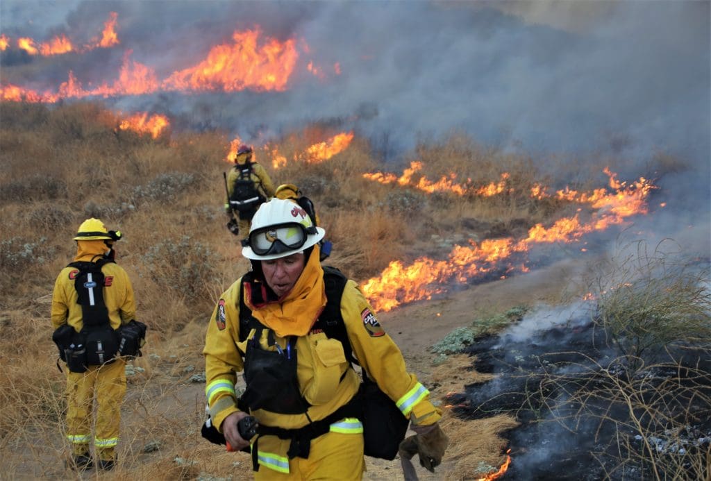
Embers remain one of the principal ways homes can ignite during a wildfire.
They can enter vents, collect in combustible materials, land on decks, accumulate against structures and ignite vulnerable components of a building.
That is why home hardening and defensible space need to work together.
California’s newly approved Zone 0 requirements place additional emphasis on the first five feet surrounding structures in designated fire-hazard areas. The objective is to reduce combustible material immediately adjacent to a building.
El Niño doesn’t change that objective.
If anything, a particularly productive growing season may make routine inspection and vegetation maintenance around structures more important.
Residents don’t need to wait for next year’s vegetation to dry before taking sensible actions.
Dead leaves can be removed now.
Roof and gutter debris can be removed now.
Combustible material stored against homes can be relocated now.
Tree branches contacting or overhanging vulnerable portions of structures can be evaluated now.
Vents, roofs, decks, windows and other vulnerable building components can be inspected now.
Preparing a home for wildfire is a year-round activity.
Defensible Space and Home Hardening Solve Different Problems
This distinction is particularly important as California begins implementing Zone 0.
Defensible space is primarily about managing the fuels and combustible conditions around a structure.
Home hardening addresses the vulnerability of the structure itself.
Neither replaces the other.
A beautifully maintained landscape surrounding a highly vulnerable home doesn’t eliminate wildfire risk. Nor does installing fire-resistant building components mean vegetation can be ignored.
MySafe:Riverside has consistently advocated managing these issues in parallel.
El Niño illustrates why.
The amount and condition of vegetation around a property can change dramatically from season to season.
The underlying vulnerability of a vent, window, roof or deck may not.
A resilient property needs to address both.
In Recently Burned Areas, Wildfire Creates a Different El Niño Problem
For communities affected by recent wildfires, the immediate El Niño concern may have very little to do with flames.
It may be water.
Fire can dramatically alter a watershed. Vegetation may be gone. Roots that helped stabilize soil can be damaged or dead. Surface conditions can change the way rainfall is absorbed.
When intense rain falls over a recently burned landscape, water can move rapidly downhill while carrying soil, rocks, vegetation and debris.
The result can be dangerous debris flows, erosion, flooding and damage to roads, utilities and property.
These hazards can occur with remarkably little warning.
A resident may look outside and see what appears to be an ordinary heavy rain while dangerous conditions are developing farther uphill in the watershed.
That is why evacuation warnings associated with burn scars should be taken seriously.
You don’t need to see a debris flow approaching your street before deciding to leave.
The Palisades and Eaton Fire Areas Deserve Particular Attention
The January 2025 L.A. fires changed substantial portions of the Southern California landscape.
As rebuilding and recovery continue in affected communities, a potentially active rainy season creates another set of challenges.
Burned hillsides and drainage systems need monitoring. Construction sites and cleared properties can be vulnerable to erosion. Temporary erosion-control measures need to function properly. Roads and access routes may be affected by mud, rocks or debris.
For residents who have already endured wildfire and displacement, another hazard can understandably feel exhausting.
But recognizing the risk isn’t the same as predicting another disaster.
It means paying attention to forecasts, understanding whether a property lies downstream from burned terrain, knowing evacuation routes and responding promptly when public-safety agencies issue instructions.
Recovery from wildfire includes preparing for what the altered landscape does next.
Heavy Rain Can Affect Evacuation Routes Too
There is another connection between El Niño and wildfire preparedness that is easy to overlook.
Roads.
Southern California’s hillside and canyon communities often have limited ways in and out. Those same roads may be affected by flooding, fallen trees, erosion, rockfall or slope failures during significant storms.
Damage sustained during winter can persist long after the rain stops.
That makes winter a useful time for communities and public agencies to evaluate access and evacuation routes.
Where are the chokepoints?
Which roads are susceptible to flooding or slope failure?
If one route becomes unavailable, what is the alternative?
Wildfire evacuation planning should never depend upon a single road remaining usable.
Understanding multiple ways out is valuable whether the immediate hazard is wildfire, flooding, debris flow or another emergency.
What About Santa Ana Winds?
One of the most dangerous assumptions residents can make is that El Niño means Santa Ana winds will somehow switch off.
They won’t.
Southern California’s offshore wind events are driven by atmospheric pressure patterns and regional geography. Their frequency, timing and strength vary considerably.
El Niño can influence larger atmospheric patterns, but it cannot guarantee the absence of a damaging Santa Ana event.
The January 2025 fires provided Southern California with a devastating reminder of what can happen when powerful winds, dry vegetation, vulnerable communities and ignition come together.
Rain doesn’t erase that lesson.
A Wet Winter Is an Opportunity
There is another way to look at the developing El Niño.
If Southern California receives meaningful precipitation, it may provide something valuable:
time.
Periods of lower wildfire potential create opportunities to improve homes, manage vegetation, organize neighborhoods, strengthen evacuation plans and complete mitigation work before the next period of critical fire weather.
Residents can inspect their homes.
HOAs can evaluate common areas.
Fire Safe Councils can identify neighborhood projects.
Communities can work with qualified experts to determine appropriate vegetation-management practices.
Public agencies can examine evacuation routes and infrastructure.
Homeowners can make incremental improvements rather than attempting everything during a Red Flag Warning.
Preparedness works best when it isn’t urgent.
Don’t Overreact to Vegetation Growth
If this winter becomes exceptionally wet, another challenge is likely to emerge next spring.
People may see enormous vegetation growth and understandably conclude that everything needs to be cut down.
That isn’t necessarily the right response.
Southern California’s landscapes are diverse. Native vegetation, ornamental landscaping, trees, grasses and chaparral behave differently. Slope stability, habitat, heat, shade and ecological considerations matter.
Vegetation management should be purposeful.
The objective is not to create a moonscape around every Southern California home.
It is to interrupt dangerous fuel pathways, eliminate accumulated dead material, maintain appropriate separation, prevent vegetation from creating pathways to structures and reduce combustible conditions immediately adjacent to buildings.
The right solution for a hillside property in Malibu may not be identical to the right solution for a home in the Hollywood Hills, San Bernardino foothills or inland Riverside County.
Local conditions matter.
Zone 0 Will Become Part of This Conversation
The timing is noteworthy.
California is beginning implementation of updated defensible-space requirements that include Zone 0—the area extending approximately five feet from a structure.
At the same time, Southern California may be entering an unusually productive growing period.
Those two developments are going to intersect.
Residents shouldn’t panic and shouldn’t begin indiscriminately removing landscaping simply because El Niño is strengthening or because Zone 0 has been approved.
There is time for local implementation guidance to develop.
But homeowners can begin with the things that already make sense regardless of regulation:
Remove dead vegetation.
Keep roofs and gutters clear.
Don’t allow piles of leaves and debris to accumulate against structures.
Move easily combustible materials away from buildings.
Inspect vegetation touching or immediately adjacent to the home.
Look for pathways that could allow fire to move from vegetation or combustible objects to the structure.
And consider the vulnerability of the building itself.
Those actions are valuable whether next winter produces 10 inches of rain or 30.
Watch What Happens After the Rain
Perhaps the most important wildfire lesson from the developing El Niño will not become apparent this winter.
It may come next spring.
Watch the vegetation.
How much grew?
Where did it grow?
How quickly is it curing?
What are fuel-moisture conditions doing?
What happens as temperatures rise?
What happens when the marine layer retreats from inland areas?
And eventually: what happens when offshore winds return?
Those questions will tell us considerably more about future wildfire potential than the label attached to El Niño itself.
Wildfire Preparedness Is a Cycle, Not a Season
Southern California increasingly has to abandon the idea of a neatly defined “fire season.”
The landscape is too varied, the weather too changeable and our communities too exposed.
A potentially historic El Niño reinforces that reality.
During periods of dry weather, we worry about fire.
When the rain begins, we worry about flooding and debris flows.
When vegetation grows, we need to manage it.
When it dries, we monitor fuel conditions.
When Santa Ana winds arrive, preparedness becomes operational.
Then the cycle begins again.
The objective isn’t to fear every part of that cycle.
It is to understand it.
Don’t Prepare for El Niño. Prepare for Wildfire.
NOAA’s current forecast deserves attention. El Niño is strengthening, there is a greater than 90 percent chance that it becomes very strong during fall and winter, and current probabilities indicate this event could reach levels not previously observed in the modern record. (Climate Prediction Center)
But nobody knows today exactly what that will mean for rainfall in a particular Southern California community—or for the 2027 wildfire environment.
We don’t need to.
The fundamentals of wildfire resilience remain the same.
Maintain defensible space.
Harden vulnerable structures.
Manage vegetation intelligently.
Keep the area immediately surrounding buildings free of unnecessary combustible material.
Know how you will evacuate.
Pay attention to Red Flag Warnings and other official information.
Support neighbors who may need assistance.
And don’t wait for smoke in the air before deciding wildfire preparedness matters.
El Niño may bring Southern California a great deal of rain.
It may bring less than people expect.
It may give us a spectacular green spring.
And months later, some of that green may become brown.
The weather will change. The responsibility to prepare doesn’t.