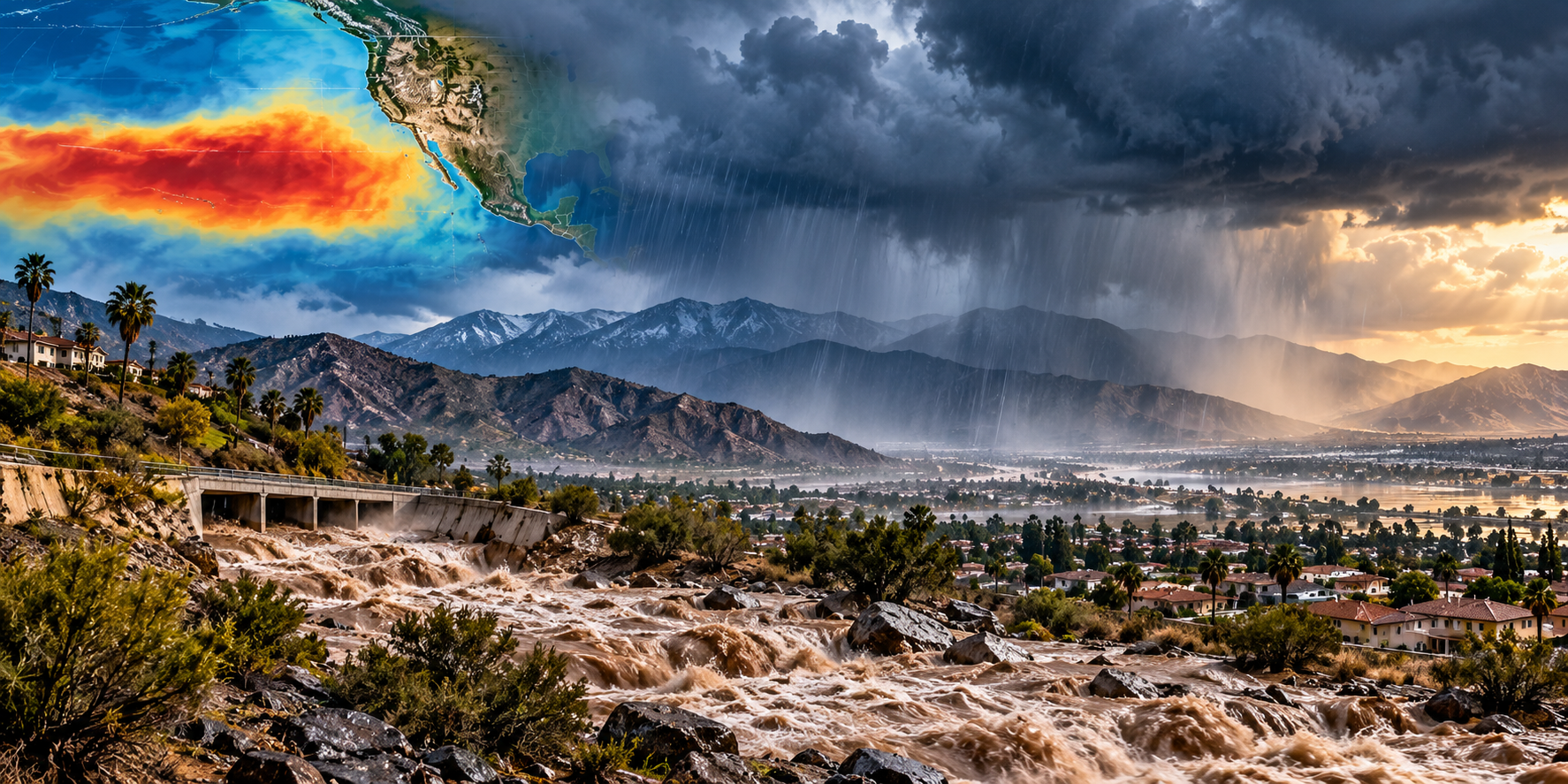
A potentially historic El Niño is developing in the Pacific. For Riverside County, the most important issue isn’t predicting how much rain will fall—it is understanding where water can go when it does.
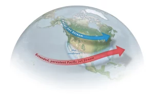
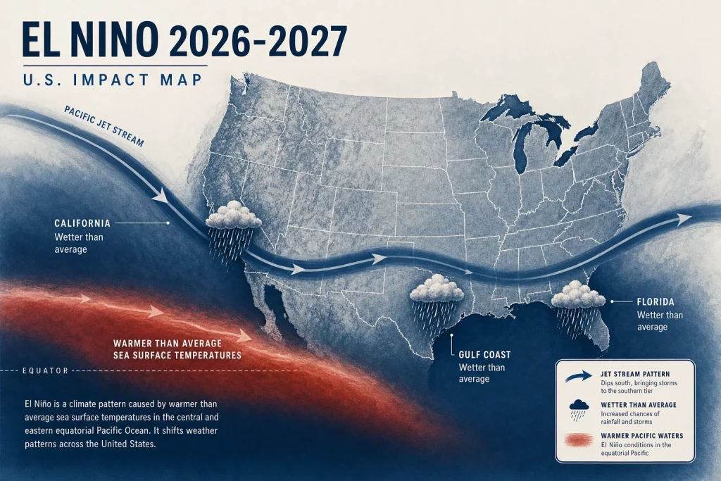
El Niño continues to strengthen across the tropical Pacific, and federal climate scientists are increasingly confident that the 2026–27 event could become exceptionally strong.
As of the latest NOAA Climate Prediction Center update, issued September 10, there is a greater than 90 percent chance that El Niño will become a very strong event during the fall and winter. NOAA currently estimates a 75 percent chance that the October-through-December period could reach a level exceeding previous El Niño events in its modern record dating to 1950. NOAA ENSO Diagnostic Discussion
That is significant. It is not, however, a forecast that Riverside County will experience catastrophic flooding.
Even NOAA stresses that a very strong El Niño only increases the likelihood of weather patterns associated with El Niño. It doesn’t determine exactly where storms will travel, how much precipitation will fall in Riverside County, or whether a particular community will flood.
The right response isn’t panic. It is preparation.
Three things everyone should understand before the rainy season begins:
1. Water moves faster than you think.
2. Burn scars change the rules.
3. Rain doesn’t end wildfire risk.
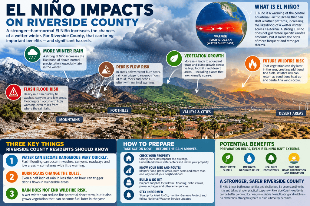
1. Flash Flooding Can Happen Much Faster Than People Expect
Riverside County is enormous and geographically diverse. It includes dense urban communities, mountains, foothills, desert, narrow canyons, washes, agricultural areas and broad valleys. Water behaves very differently across those environments.
One reason flooding is particularly important here is the prevalence of washes, low-water crossings, drainage channels, canyons and desert terrain. Heavy rainfall may fall miles away from the location eventually affected by flooding.
A thunderstorm over the mountains can send water rapidly downstream into areas where residents haven’t experienced much rain at all. A normally dry wash can become dangerous very quickly. A familiar road can become impassable. A low crossing can disappear beneath muddy water.
Flash flooding is exactly what the name suggests: flooding that develops rapidly, often after intense rainfall and sometimes with very little warning.
Never enter moving floodwater on foot or in a vehicle.
Riverside County Flood Control advises residents to stay out of dips, low spots, canyons and washes during flooding and provides detailed storm-preparation guidance. Riverside County Flood Control storm preparation
If a road is closed because of flooding, do not drive around the barricade. Water can conceal damaged pavement, debris, or a washed-out roadway. You cannot judge the safety of a flooded road simply by looking at the surface.
2. If You Live Below a Burn Scar, Rainfall Rate May Matter More Than the Storm Total
Wildfire changes what happens when rain reaches the ground. Vegetation that once slowed and absorbed rainfall may be gone. Roots may no longer hold soil in place. In severely burned areas, soil can sometimes become water-repellent. Instead of soaking into the ground, water may move downhill rapidly.
That creates the potential for flash flooding, erosion and debris flows. This is particularly important in Riverside County because of the county’s combination of wildfire history and steep terrain.
Debris flows are not simply muddy water. They can be violent mixtures of water, mud, rocks, trees and other material moving rapidly downhill—and they can begin quickly.
The total rainfall predicted for an entire storm may not be the number residents should focus on. Intensity matters. Three inches falling gradually over a day is very different from an intense burst falling over a burned watershed. And the weather over the watershed matters more than the weather directly above your house.
Riverside County Emergency Management provides specific guidance for residents near recent burn scars, including the possibility that runoff may exceed normal drainage capacity and that roads can become blocked or damaged. RivCo Ready burn-scar and flooding guidance
If officials issue an evacuation order because intense rainfall is expected over a burn area, do not wait until you can see mud or debris coming toward you.
3. El Niño Does Not Mean Riverside County’s Wildfire Risk Is Over
More rain can reduce wildfire potential in the short term. Wet vegetation generally burns less readily than dry vegetation. Significant winter precipitation can raise fuel moisture and interrupt periods of extreme dryness.
But rain also grows vegetation—and in Riverside County, that relationship deserves particular attention.
Wet years can produce substantial vegetation in normally sparse environments. As that vegetation cures and dries, it can become additional fine fuel capable of carrying fire when heat, wind and ignition return.
Rain → vegetation growth → curing and drying → additional fine fuels → wildfire opportunity when heat, wind and ignition return.
That doesn’t mean a wet winter causes wildfire. It means rainfall changes the fuel environment. Grasses that are green in February can become continuous dry fuel later in the year.
El Niño does not turn off Santa Ana winds. It does not prevent ignitions. And it does not make a vulnerable home resistant to embers.
For current local wildfire-preparedness information, residents can use Riverside County Fire Department and CAL FIRE’s Ready for Wildfire resources.
What Should Riverside County Residents Do Now?
Know Where Water Will Go
Walk your property before the first major storm. Look at roofs, gutters, downspouts and drainage. Where does water leave your property? Where does it enter? Is a drainage path blocked by leaves, vegetation or stored materials?
Do you live near a drainage channel, wash, creek, canyon or low area? Local history matters: if neighbors remember water crossing a roadway or filling a wash during previous storms, pay attention to that history.
Prepare Your Home Before the Storm Is Forecast
Clear gutters and downspouts, address obvious drainage problems, check roofs and leaks, protect valuables, and prepare emergency supplies before storms arrive.
Sandbags can help redirect ordinary water and reduce some property damage when used properly, but they should never create a false sense of security during a major debris-flow threat.
Know More Than One Way Out
Flooding and wildfire have something important in common: your normal route may not be available. A canyon road can be blocked by mud. A low crossing can flood. A tree can fall. A slope can fail. A wildfire can close the same road you planned to use.
A household should not have one evacuation route. It should have alternatives.
Have a GO Kit That Works for More Than Wildfire
If you already maintain a wildfire GO bag, you have completed part of your storm preparation. The same kit can support you during wildfire, flooding, debris-flow evacuation, power outages, earthquakes or temporary displacement.
Include medications, important documents, water, basic food, chargers, backup power, flashlights, clothing, personal-care items and supplies for pets.
Get Emergency Alerts Before You Need Them
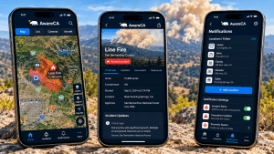
Riverside County residents should make sure they can receive local emergency information and understand the difference between watches, warnings and evacuation instructions.
County preparedness and alert information is available through RivCo Ready. Evacuation information may also be distributed through Genasys Protect.
Preparation Pays Even if El Niño Underperforms
Nothing described above depends upon a historic El Niño. Riverside County will experience heavy rain again. There will be flash floods again. There will be wildfires again. There will be power outages. There will be earthquakes. There will be evacuation orders.
Cleaning drainage protects a property during an ordinary storm. Creating a household communication plan works during an earthquake. Knowing alternate evacuation routes helps during wildfire. Organizing medications and documents helps during any evacuation. Maintaining backup power is valuable during both wildfire-related outages and storm outages. Preparing animals for evacuation works whether the reason for leaving is fire, flood or debris flow.
In that sense, El Niño can provide something valuable even if this year’s event does not produce extraordinary local weather: motivation to prepare.
A Wet Winter Can Also Be a Wildfire-Preparedness Opportunity
Periods of reduced wildfire activity give homeowners and communities time to do work that is much more difficult during extreme fire weather.
Residents can assess defensible space, identify home-hardening improvements, inspect vents, roofs, decks and fences, remove accumulated combustible materials, organize neighborhood preparedness, evaluate evacuation routes, and determine how vegetation will be managed before new growth dries.
A wet winter does not change the fundamentals of wildfire resilience. It may simply change when some of the work needs to occur.
Watch the Spring
If Riverside County receives significant rainfall this winter, one of the most important wildfire indicators may become visible next spring: vegetation.
Watch how much grass and other fine fuel grows. Watch roadside areas, vacant lots, open-space interfaces and areas that normally contain sparse vegetation.
When that vegetation is green, it may not look threatening. Eventually, however, it cures. The time to begin thinking about that transition is not when everything has already turned brown. It is while the landscape is still green.
The Three Things to Remember
First: El Niño is not a storm. It changes the odds of certain weather patterns. It does not guarantee how much rain Riverside County will receive.
Second: In Riverside County, water can become dangerous very quickly. Flash floods can occur in washes, canyons, roadways and low areas—and rainfall over a burn scar can create dangerous conditions downstream even when it is not raining heavily where you are.
Third: Rain and wildfire preparedness are connected. Rain can reduce immediate wildfire risk while simultaneously growing vegetation that may become future fuel.
The safest approach is not to choose between preparing for flood or preparing for fire. Prepare for both.
Prepare for the Conditions We Know Will Return
Scientists will continue watching El Niño closely. NOAA’s next formal ENSO diagnostic update is scheduled for October 8, and forecasts will continue changing as winter approaches.
Whether this event ultimately becomes historic is not the most important question for a Riverside County household. A more useful question is: If heavy rain, wildfire or another emergency affected my community tomorrow, would my household be ready?
If the answer is not yet yes, this fall provides an excellent opportunity to change it.
Inspect your home. Understand your flood exposure. Clear drainage. Know your evacuation zone. Identify alternate routes. Prepare your GO kit. Plan for pets and animals. Maintain your defensible space. Harden vulnerable parts of your home. And pay attention to official information when conditions begin changing.
El Niño may ultimately bring Riverside County an unusually wet winter—or it may not. Preparedness will have value either way.
Useful Resources
- NOAA Climate Prediction Center — ENSO Diagnostic Discussion
- Riverside County Flood Control — Storm Preparation
- Riverside County Flood Control — Floodplain Information
- RivCo Ready — Emergency Preparedness
- Riverside County Fire Department
- CAL FIRE — Prepare for Wildfire
- Genasys Protect — Evacuation Information